When I drive into The Hague from the north, I always use the “Landscheidingsweg”, or “land-dividing road”. The other day, whilst driving home, I wondered which “lands” are divided by this road.
Below sea level
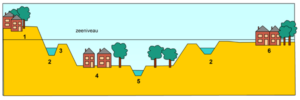
 Whenever I read the word “polder”, I hear my geography teacher’s voice in my ear: “A polder is a piece of land enclosed by dikes in which the water level is artificially maintained”. Over 50% of The Netherlands lies below sea level, on polders created over hundreds of years, even into the 20th century. This means that maintaining our water level is quite literally a matter of life and death.
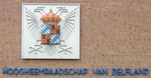
During the Middle Ages the inhabitants of the Low Countries realized that cooperation among all levels of society was crucial to good water management. And this cooperation needed organization.  This organization took the form of water boards ( in Dutch, “waterschappen” or “hoogheemraadschappen”). The first official waterschap was the “Hoogheemraadschap van Rijnland”, founded in 1255 by Count William II of Holland. Over the centuries, the waterschappen have made sure that the dikes have stayed strong and that any surplus water has been pumped away, first with windmills, later with steam pumps and in the present day with electrical pumping stations.
“Polderen”
The need to cooperate has become part of the Dutch culture, as is illustrated by the verb “polderen”. Put 2 or more Dutch persons in a room and they will start to negotiate a compromise and aim for consensus. I can understand that this amazes (or even annoys) foreigners. They must notice the long time it takes before decisions are made. But they should also see that often the decision is accepted by everyone involved.
Landscheiding
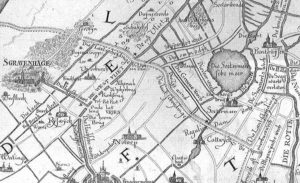
 The “Hoogheemraadschap van Rijnland” lies next to the “Hoogheemraadschap van Delfland”. The “Landscheiding” was a dike between Rijnland en Delfland. Its function: to prevent water flowing from Rijnland into Delfland. On average, the water level in Rijnland was 1 meter higher than the water level in Delfland. Nowadays it is just the other way around. The dike was commissioned by Count Floris V of Holland and was first mentioned in a 1285 charter.
Until the last century the dike was visible in the landscape. Over the years the polders have been made higher, so that the old dike is now hidden. The Landscheidingsweg follows part of the dike.
The “waterschap” over the years
 Every occupier of The Netherlands has left the waterschappen to their own devices. Spaniards, French and Germans understood quite well that it was best to leave the water management to the Dutch themselves.
Over time, the job of the waterschappen became larger than building/maintaining dikes and pumping water. In the 19th century, people became aware that the quality of the water was crucial to public health. That’s when the waterschappen became responsible for water purification. Every day the “Hoogheemraadschap Delfland” makes sure that in The Hague we keep our feet dry and that our sewage is purified before being discharged into the sea. Think about that when you drive on Landscheidingsweg or when you flush the toilet!
I tell you more about the water of The Hague (fresh and salt) during my bicycle tour ‘The Hague – From city to sea’


1 thought on “Dry feet in The Hague”
this is very interesting! thank you Jacqueline for publishing it! Katrin